Mount Gilead White
Opening and Closing
1870's - 1934
An 1844 indenture existed that was reserved for a school house; but no record exists of it having been built. Mount Gilead, History and Heritage, pg. 145.
Physical and Map Location
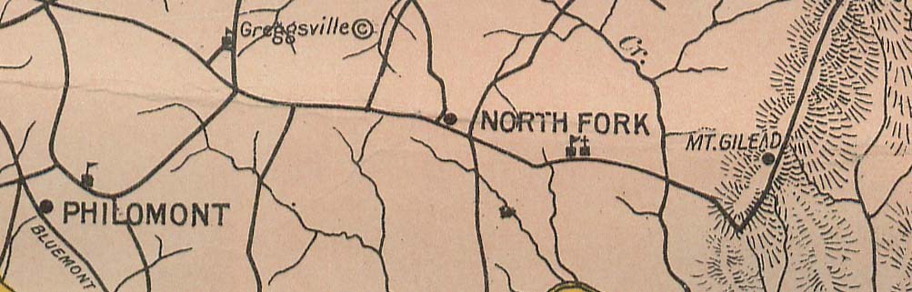
Map above shows relationship of Mt. Gilead in its District to North Fork, Philomont and Greggsville. Source is 1923 map of Loudoun by OL Emerick, Superintendent of Schools.
Petitions
Transportation
Walking was a common method of school transportation even before the creation of Loudoun County Public Schools (LCPS). It’s believed that students who lived within 3 miles of a school could walk from their home to school. The figure at https://edwinwashingtonproject.org/s/ewp/item/31321 shows the location of the school with a circle representing the area from which students could have walked, back and forth from their home to the school. Travel by horse was also used and could have extended the travel distance.
History
A one story frame Mount Gilead public school was built in the early 1870’s for white students on a 3/4 parcel of land along Mount Gilead Road. It also served as Mount Gilead’s Town Hall, then closed permanently in 1920 and was destroyed by fire before 1930. After the closure, children walked to North Fork, which also closed in 1934, at which point they went to Lincoln School. Source: “Schools at Mount Gilead,” pg 144 in Mount Gilead, History and Heritage, by William C. Ray, 2010, Leesburg.
Instructors
Insurance and Physical Description
A one story frame Mount Gilead public school was built in the early 1870’s for white students on a 3/4 parcel of land along Mount Gilead Road.